


Luxembourg end-to-end internet communications service for humanitarian crises emergency.lu plans to deploy AI-based aerial imagery analysis tools to assess disaster zones within the next three years.
The service, which became operational in 2012, provides internet communication for humanitarian actors, local government and citizens in areas impacted by disasters.
“On top of the internet connectivity we provide, we are working on solutions to be able to analyse mainly drone imagery on site using AI tools,” Gilles Hoffmann, emergency.lu coordinator, told Silicon Luxembourg.
The technology, which could be developed with respondents to the recent call for humanitarian innovation accelerator projects , would help responders in the field better understand the impact of a disaster by identifying flooded areas and assessing the extent of damage caused by earthquakes.
The service has developed a proof of concept using an AI solution built into the satellite terminals. Hoffmann explained: “So instead of transferring all the imagery through the satellite to some data center to analyse it, we would be able to run the AI tools locally.”
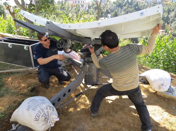
emergency.lu was developed after feedback from Luxembourg search and rescue teams that participated in rescue operations in Haiti following the 2010 earthquake there. A lack of communication infrastructure was identified as a key barrier to relief efforts. Luxembourg’s foreign affairs ministry created a public private partnership with Luxembourg Air Rescue and satellite companies SES and Hitec to develop and deploy the solution.
The solution comprises a satellite antenna pointed to a pre-booked satellite, and a downlink station, is deployed by the humanitarian intervention team of the Luxembourg Fire and Rescue Corps, following a request from a country impacted by a disaster.
It has been operational in Turkey’s Hatay province since 9 February, where it provides critical internet connectivity enabling the coordination of relief efforts.
“Today people are heavily relying on technical tools like laptops, emails, phones, and so on. So for them it’s super important. But also for the population, to contact family and friends and give an update and access information,” said Hoffmann.
Another “game changer” evolution of the solution will be the future shift from using only geostationary satellites, orbiting at about 36,000 kilometres from the Earth, to medium-Earth orbit satellites. The switch is expected to boost downlink capacity from 10-15 megabits per second to 100-200 megabits per second. Hoffmann also did not rule out the possible future use of low Earth orbit satellite constellations.


