


Spacety announces a new space launch a mere 6 weeks after its previous launch. On December 22, two of Spacety’s satellites – Hisea-1 and Yuanguang – were successfully launched into space on the inaugural flight of the medium-lift Long March 8 (LZ-8) rocket, from Wenchang, China.
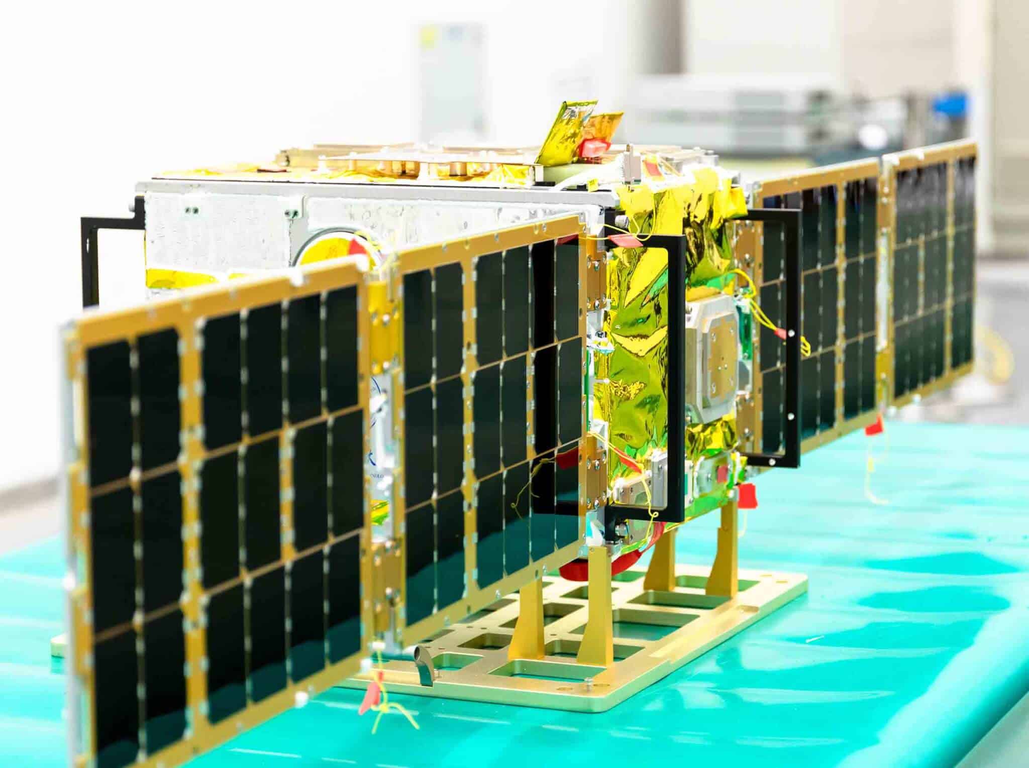
Image Credit © Spacety
Hisea-1 is Spacety’s first commercial Synthetic Aperture Radar (SAR) satellite, and is also the world’s first commercial C-band small satellite SAR with a phased-array antenna. Yuanguangis a 12U satellite for scientific experiments of mechanism and tribology in space.
Imagine being able to reconstruct landscapes or cities with an almost instant refresh rate, on sunny or rainy days, as well as nights. Defence and intelligence applications would come immediately to mind, but even the commercial uses of such information are tremendous. Hisea-1 was launched to meet the needs for monitoring ocean and coastal areas and ocean research. The imagery from the satellite will also be used for disaster management, agriculture, infrastructure monitoring, and so on.
Synthetic Aperture Radars (SAR) are basically like bats – not affected by daylight and weather conditions, unlike optical sensors. Now the era of SAR satellites has arrived and Spacety is planning to build, launch, and operate a constellation of 56 small SAR satellites. “Hisea-1 is the first launched satellite of TY-MINISAR, the first generation of light and small SAR satellites being developed by Spacety. The constellation based on TY-MINISAR benefits from low-cost, fast deployment, strong coverage capability with a high revisit frequency, and flexible scheduling. As a result, the constellation can produce images of high resolution, wide-coverage, and continuous monitoring, and will provide customers with more efficient remote sensing services”, says Justin Feng, the founder and CEO of Spacety. Hisea-1 has a mass of 185 kg and uses a phased-array antenna. It has three imaging modes with the finest resolution of 1m x 1m.
“The constellation can produce images of high resolution, wide-coverage, and continuous monitoring, and will provide customers with more efficient remote sensing services.”
Onboard is ThrustMe’s Iodine Electric Propulsion system, which provides the satellite with crucial orbit maintenance, collision avoidance, and de-orbiting at the end of its three-year expected lifetime, thus ensuring an economical solution for the environmental sustainability of satellite constellations and the space industry. Spacety is very conscious of space sustainability issues, and already has active de-orbiting devices on its satellites, including these two just launched.
Though a young space company, Spacety has already launched 21 satellites with 12 launches in less than 5 years. More satellites are expected to go to space in 2021 for the SAR constellation and also to provide IOD/IOV and satellite hosting services to clients.
Spacety is a fast-growing company providing satellite-based services globally. It was founded by its CEO, Justin Feng, and its CTO, Ren Weijia in China in 2016. It established its international headquarters in Luxembourg in 2019. A world leader in CubeSats and SmallSats, it has developed, launched, and operates 21 satellites for science and technology demonstration missions.
As a leading provider of satellite-based services, it provides fast, frequent, flexible, and low-cost space missions with its advanced and reliable small satellite fleet. These space missions support science experiments and observations, and in-orbit demonstrations, and/or validations of space technologies and products or space systems. The quick turnaround and end-to-end services have enabled world-class space research and helped innovative space technologies to gain space heritage.
Spacety is building and deploying a microwave-based SAR satellite Earth Observation Constellation to provide the world with global coverage and real-time imagery data as a Service (DaaS). This C-band SAR constellation will monitor and observe the Earth, day and night, rain or shine, and make SAR imagery of every point on Earth accessible and affordable to users. The SAR data will be distributed worldwide and will enable innovative solutions to manage our changing world and make it better.
This article is brought to you by Spacety and reflects only the opinion of the author.